Map making process
We naturally distinguish between places that are real and those that are fantastical or imaginary. The problem is that the distinction is not clear-cut. Maps can contain a mixture of both the real and the imaginary. Many of them are products of the wildest imaginations, and are immersive places of escapism. Yet all of them retain vestiges of the "real" world in which they were created – whether because of a particular feature illustrated in it, the way in which it has been drawn, or even the "real-world" contexts which inspired it.
Quote from British Library’s map curator, Tom Harper: What is a fantasy map?
Sometimes I have a strict narrative and detailed description of the map and history I am drawing.
At other times a have an idea that starts of the map, and I go from there, it is fantasy. In the map detailing the narrative will reveal itself.
Sometimes I just don't have a fucking clue.
The world is ever changing...
Mapmaking is an old and well described discipline yet there are no rules other than those you define, and what your fantasy dictates and possibly the audience you want to reach, but there are details and learnings from the field that I found usefull, it is definitely worth taking a bit of time investigating before you forge ahead.
Other sources of information
There are plenty of resources and people willing to share their experiences on the web as well as map generators of different types to help you get started. There are tons of fantasy maps with different purposes and creation processes to lend you inspiration. On Youtube you can find an abundance of instruction videos, detailing the overall process as well as how to draw different map elements. Make your own journey through it all, and save yourself the frustration of "oh, why didn't I know that".
Personally I found most of my initial inspiration from searches like:
- Fantasy+maps
- Fantasy+map+drawing
- Map+making
- Fantasy+map+icon+sheets
Some external resources that I go to, when I need inspiration, a new map or a set of names.
guide-to-making-an-antique-looking-fantasy-map
Donjon Fantasy World Generator
Azgaar's Fantasy Map Generator
Watabou's Medieval Fantasy City Generator
Inkarnate map Generator
Getting started
When drawing maps i usually start by creating the map draft on a computer. If you're working of a master map, this will help you frame maps with good balance.
There are many nice map generators that help generate realistic and geopraphical correctly maps, if you're looking to experiment.
I scale the maps to ensure the dimensions match my canvas and pre-process them in a drawing program, before printing the final draft.
I don't detail the maps yet, that is journey I savoir for the canvas.
The canvas of my choice is paint-cover cardboard, 100% recycled paper, thick with lots of wonderful structure and texture, but also a little fragile, bending is not allowed.
The surface is full of imperfections and colorspecks, providing an almost living background.
But also a very challenging surface to draw small details particularly in unforgiving ink.
Sometimes there's chunks of nastyness or small woodchips embedded in the surface that makes drawing a straight line, in freehand, impossible.
Applying ink to small labels is a risky business.
But despite all its imperfections and challenges I'm in love with this material and the life it lends to its creations.
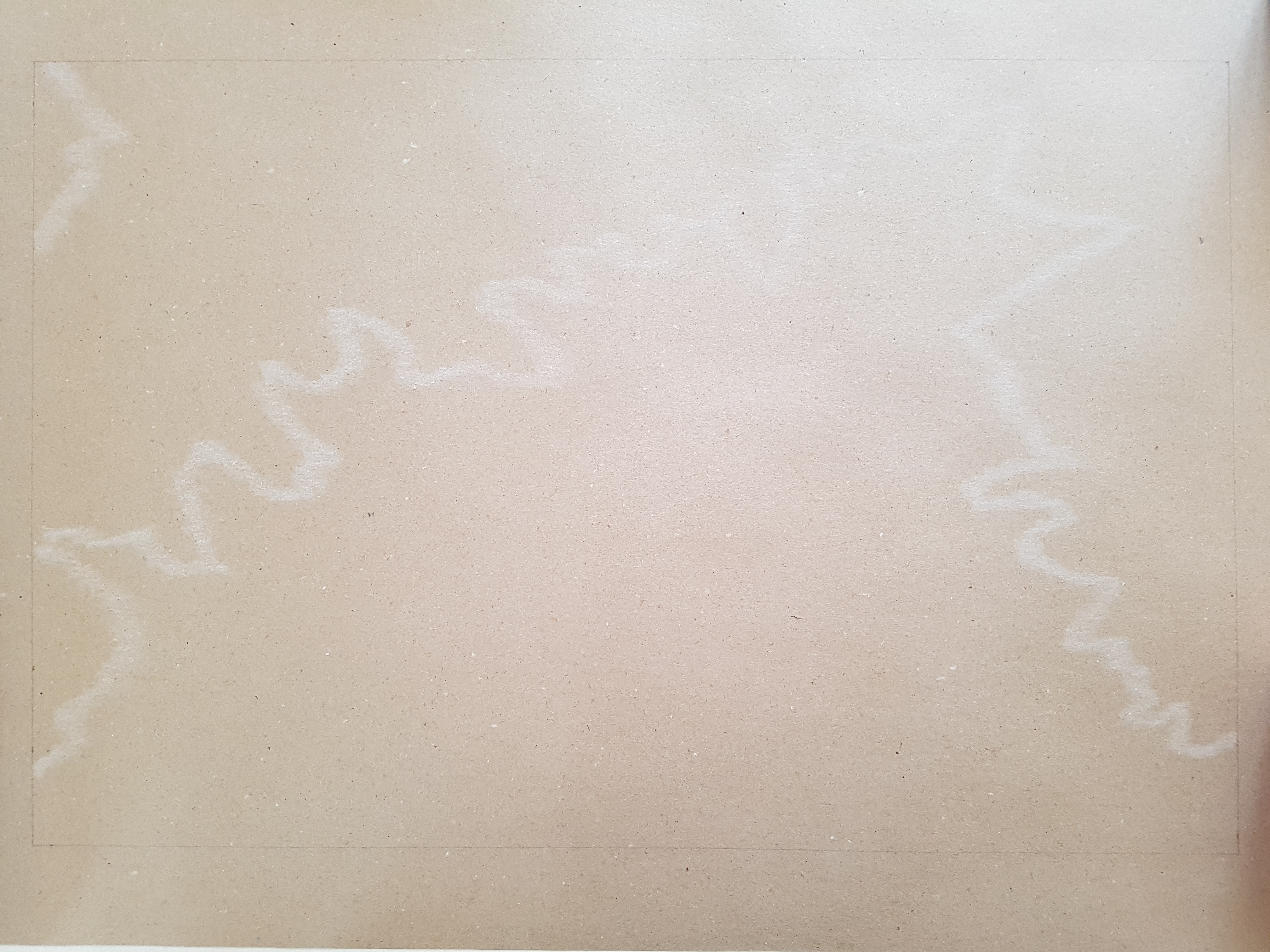
If we zoom in on the blank canvas...
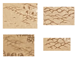
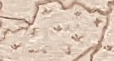
Coastal lines and major bodies of water
On the empty canvas i sketch the coastline from the original and detail with a mechanical pencil. I may add further detailing to the coastline if it has been scaled up.
I either dash the outside of the coast line or brush it outwards with a paperpen. Sometimes I add hi-lights and sometimes i mix a little a everything. But I stay consistent within one map, there'll be another canvas waiting later.
Creating coastlines on the fly so to speak, can be difficult. One thing I found works is repetitions on different scales. Nature is repetitive, the repetitions of outlines are "variations of" or "the same", on an ever decreasing scale. Unrelated note: These variations can be described and predicted with math by using fractal equations.
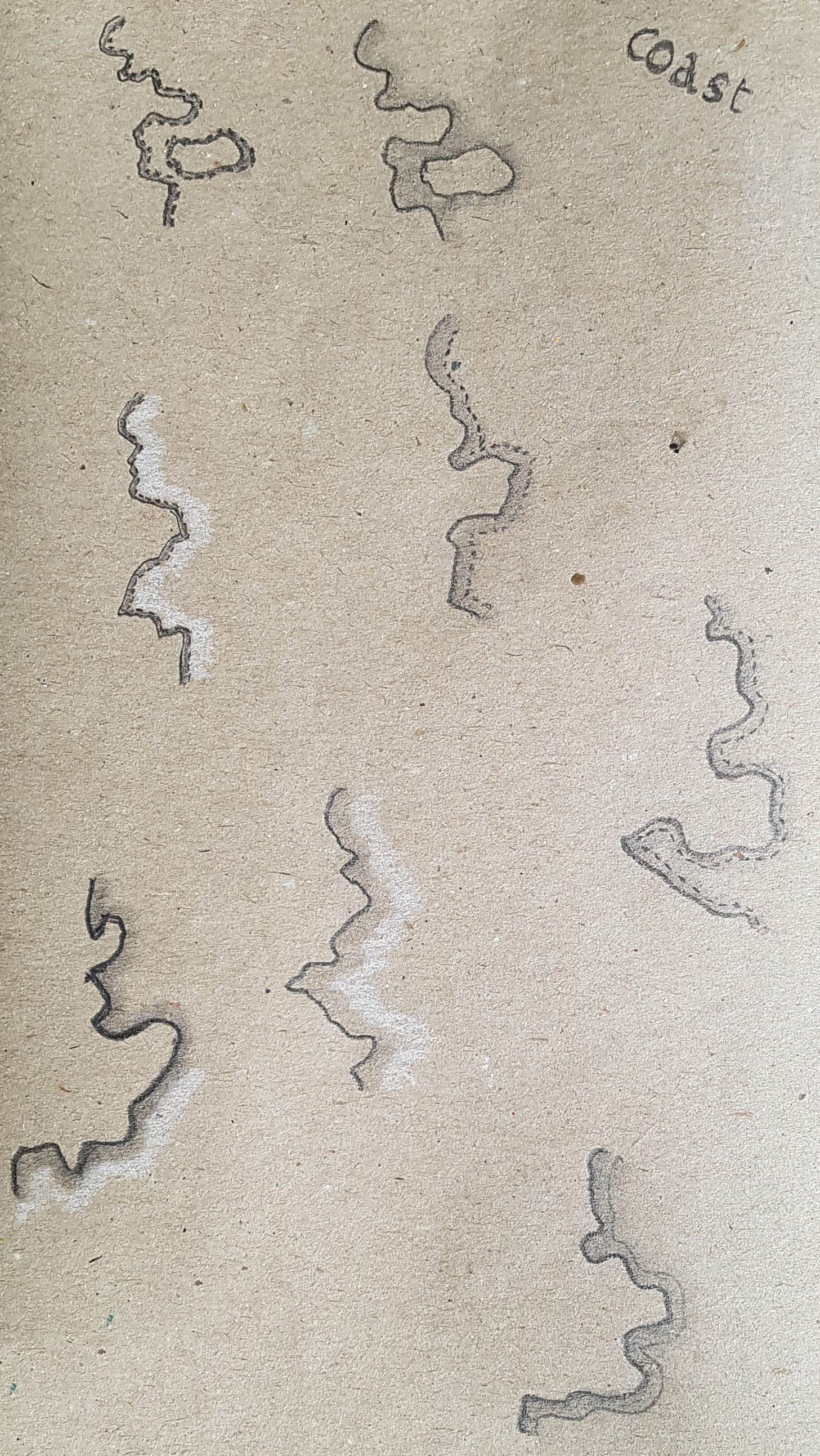
Different types of coastlines I use.
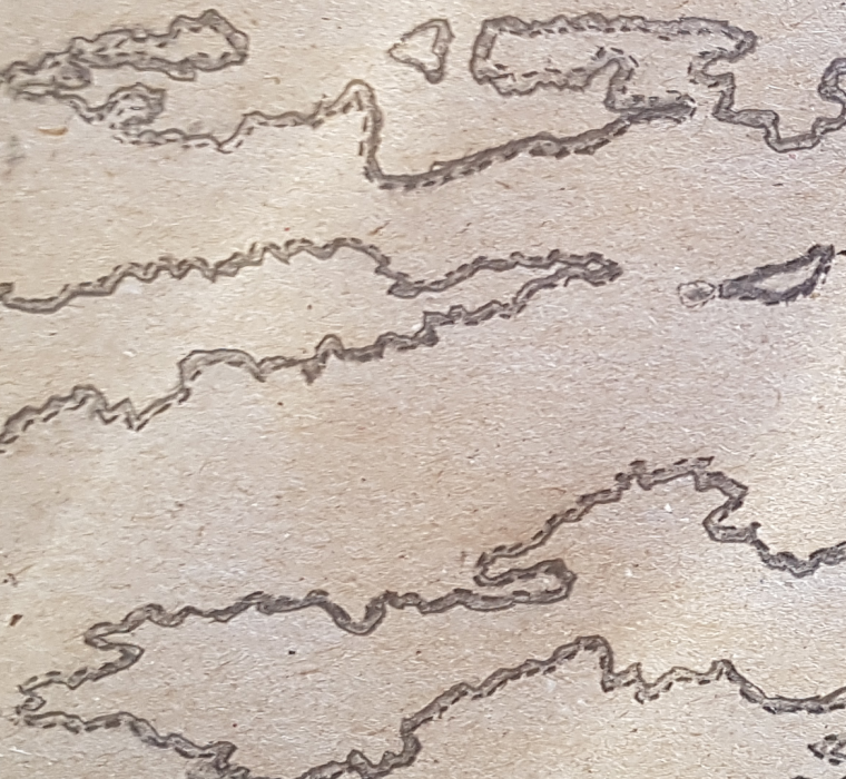
Blurry line, outlined with dark pencil. Dashed on the seaside.
Soft black costal line, brushed with paperpen.
Same as first image but with highlighted coastline.
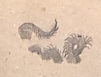
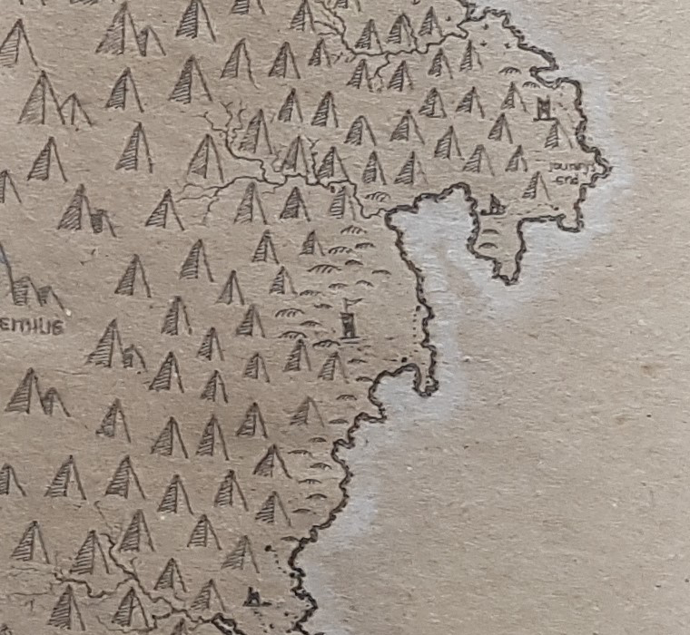
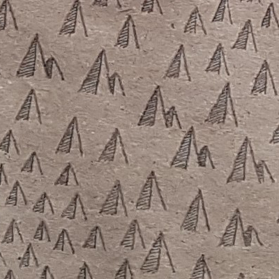
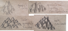
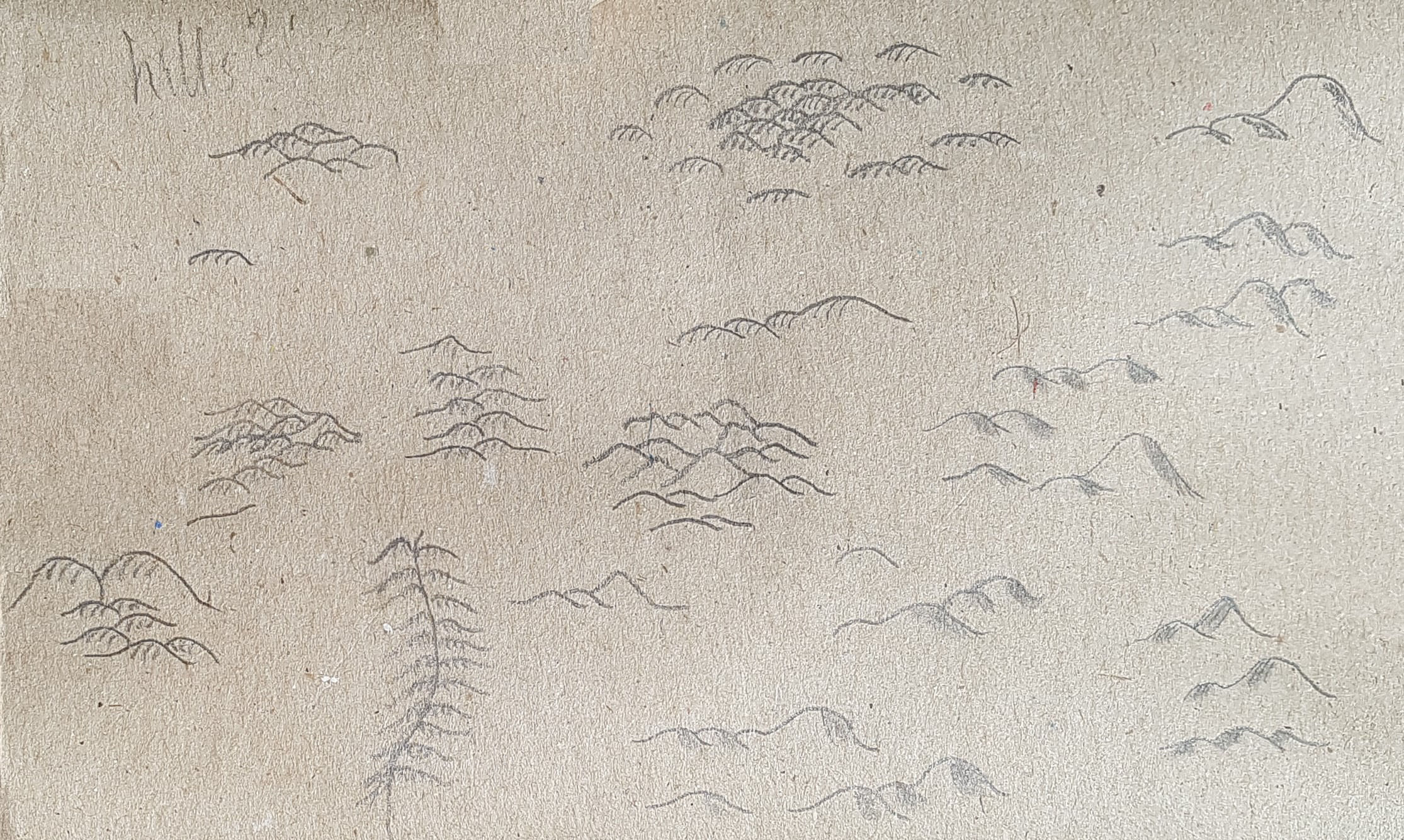
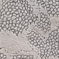
Mountains
Next I add elevations, mountains, hills, chasms, craters. Mountain area are extremely defining and will usually dominate an area. I have never laid down mountains randomly, as a minimum I have the coastline and mountains laid out in my preprocessing. That's not to say, you can't and that it doesn't work, it all depends on style and taste I guess.
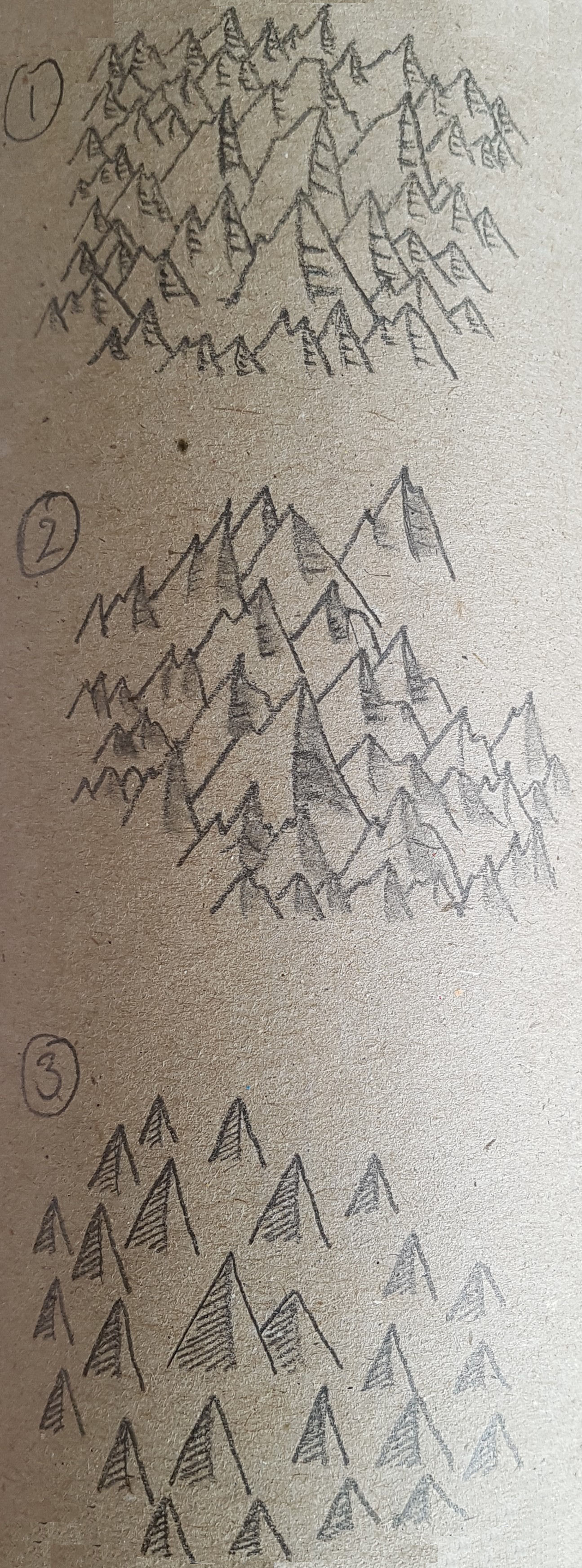
Mountains.
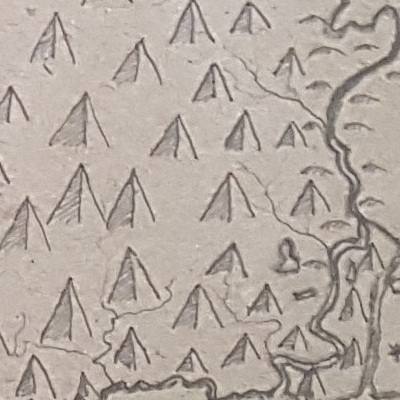
Single mountains with hatch shading.
Semi clustered mountains with hatch shading.
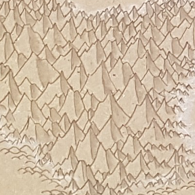
Clustered mountains, shaded with dark paperpen. traced on the edges with white.
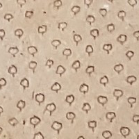
Hills
Once I have added the mountains I usually do some or all of the hill and other types of elevation and chasms, I may also do some of it in the as fillers.
Hills.
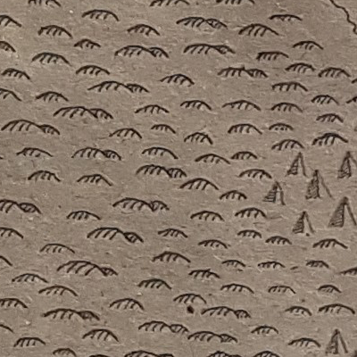
Hills, semiclusted and hatched.
Naked clustered hills.
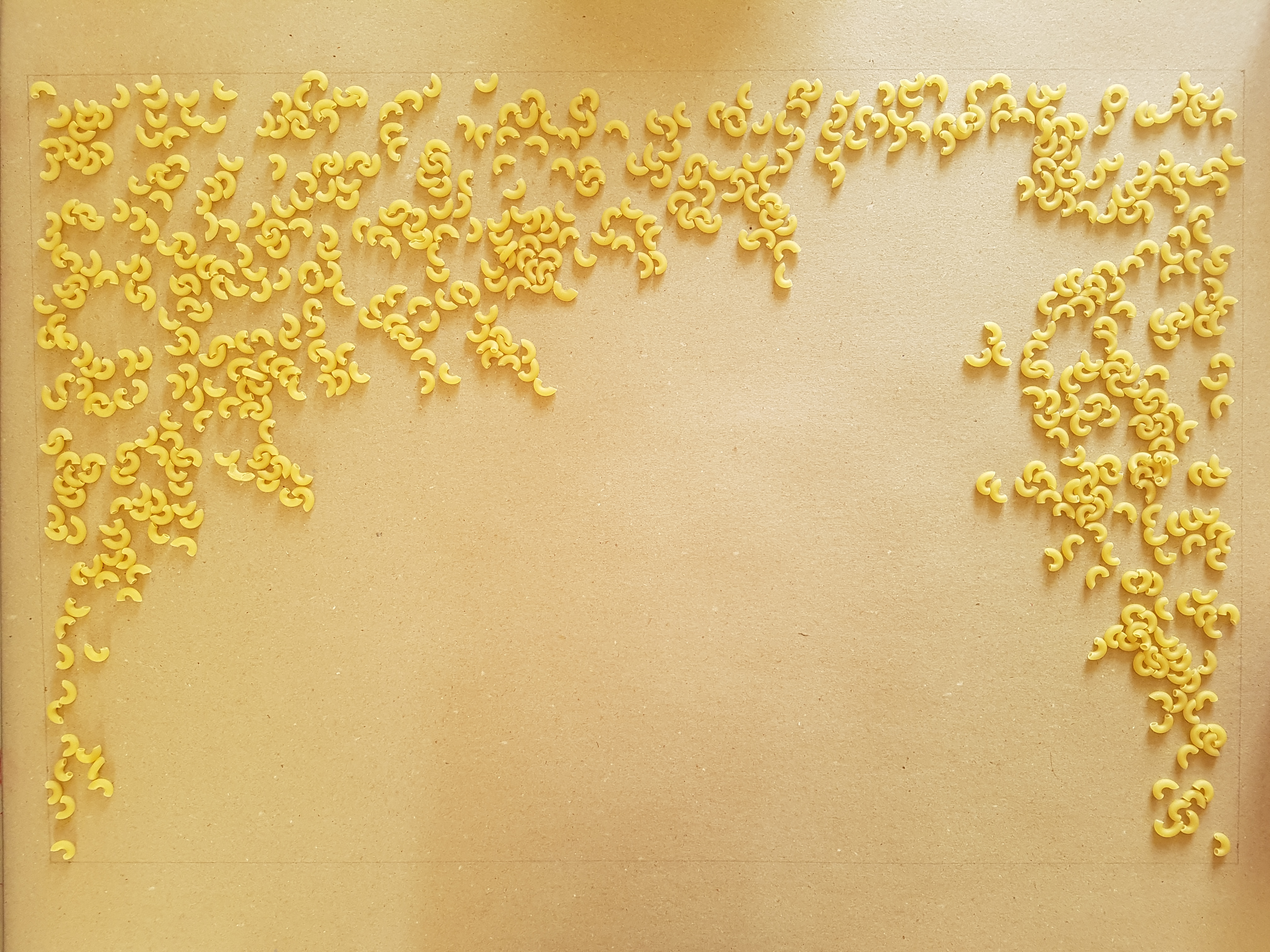
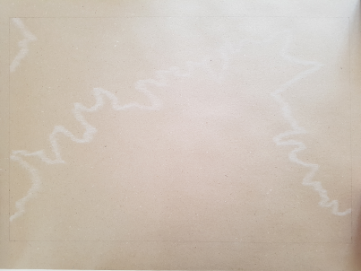
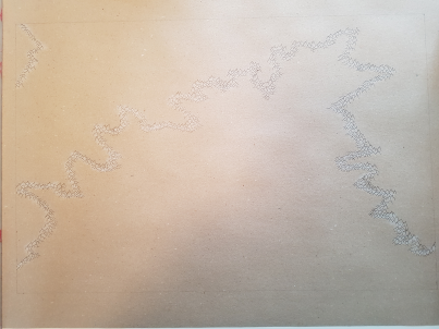
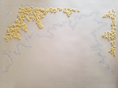
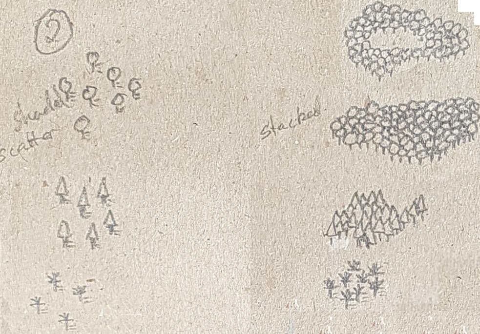
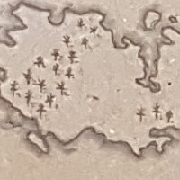
Noodle Doodling
Inspired by some Youtube videos on planning your world and the videos from "WASD202 in particular I have used noodles to layout the major forests of Feinland and Astrantia to get a feel for how much was needed. It's a neat process because it lets you work with the composition of the whole map, you can make out where the forest is too heavy and maybe identify areas that needs more work. If your narrative isn't already detailed now is certainly the time.
Doodling forests
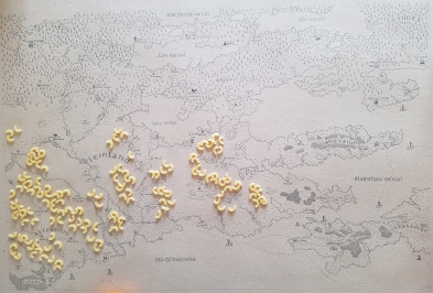
Doodling mountain outlines
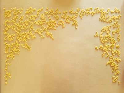
Doodling mountain ridges
Cities and labels as well
Take a look at WASD20's video he explains it well. He also has tons of video lessons on how to draw maps and map elements, he is experienced plus he's got a nice relaxed attitude and take on life in general.
How to Draw a Fantasy Map (Part 1: Landmasses)
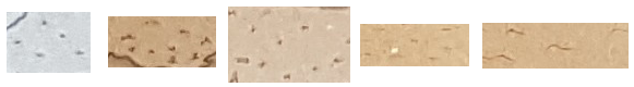
Forests
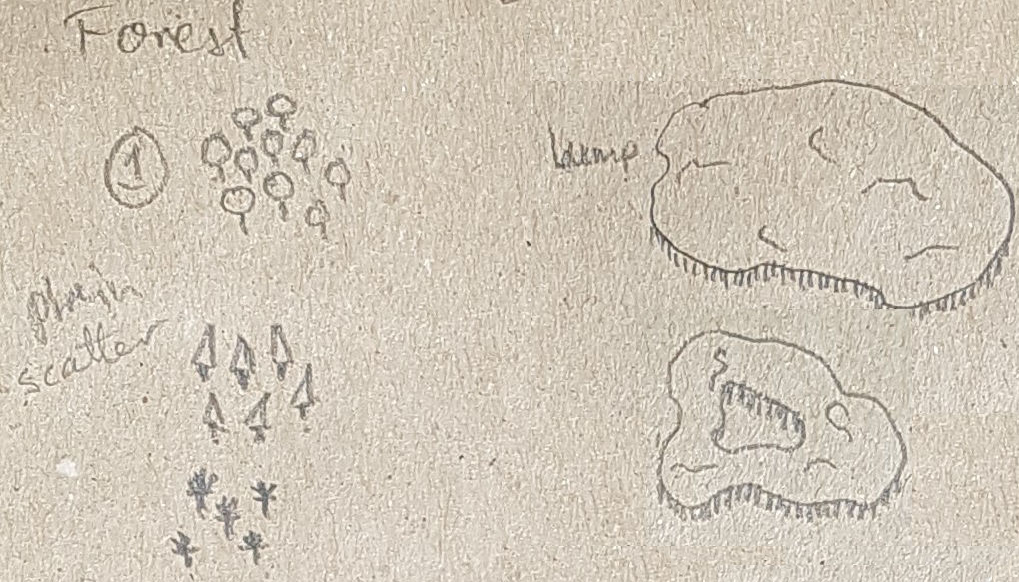
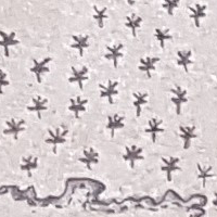
Trees
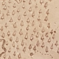
Coniferous trees, pine, spruce, plain.
Broad-leaved trees, plain.
Jungle plain.
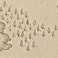
Coniferous trees, pine, spruce, heavy trunk and shade.
Broad-leaved trees, clustered.
>
Jungle, shaded.
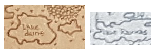
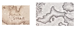
Rivers, lakes, fjords and straits
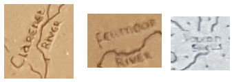
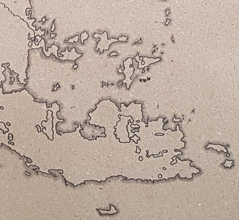
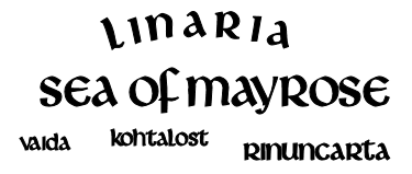
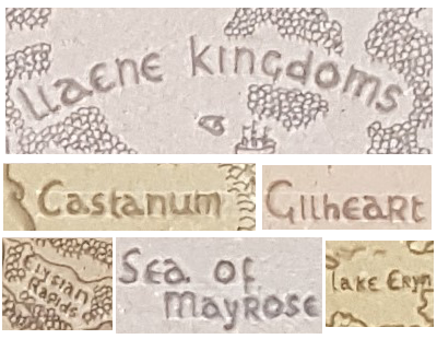
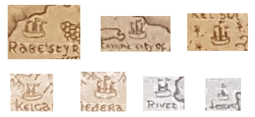
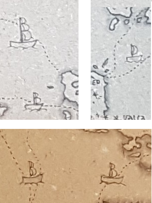
Location names, Cities and trade routes/ships
Coming up with a bunch of names for a region or larger area can be tricky, my own mind often traps me into the same patterns so I mostly use something external to trigger the process. Sometime I use name generators, sometimes just to get inspiration but often I'll grab a few names off the list and build on those. Another approach is cracking out my old Atlasses (I have a few from before the fall of the Berlin wall), select a country and look at the nomenclature and characteristics of those names for inspiration. I use some of the names as they are but alter others as I see fit.
For example I have taken most, if not all, of the inspiration for making Feinland and Astrantia, from a map of Finland(Suomi) and from listening to finish music(Lovely).
For the fantasy maps I go with the font called Livingstone. Livingstone is a gothic, celtic font designed by PrimaFont. The font is licensed as Free. The font is free for both personel and commercial usages.

The font is simple but has a nice fantasy touch to it. Notice how the "y" creeps under its predecessor, the font world version of "neutral zone infraction".
Swamps, deserts, plains and other squigglies
Plains
Wetlands, swamps, marsh.
Desert
Narlies, sometimes a random doodle is all you need.
Map progressions
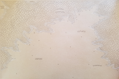
Our starting point (map generated on Donjon)
First we lay down coastallines, bodies of water and rivers

We add mountain outlines in white and start drawing mountains

And yet more mountain detailing

Finishing the mountains with paperpen shading

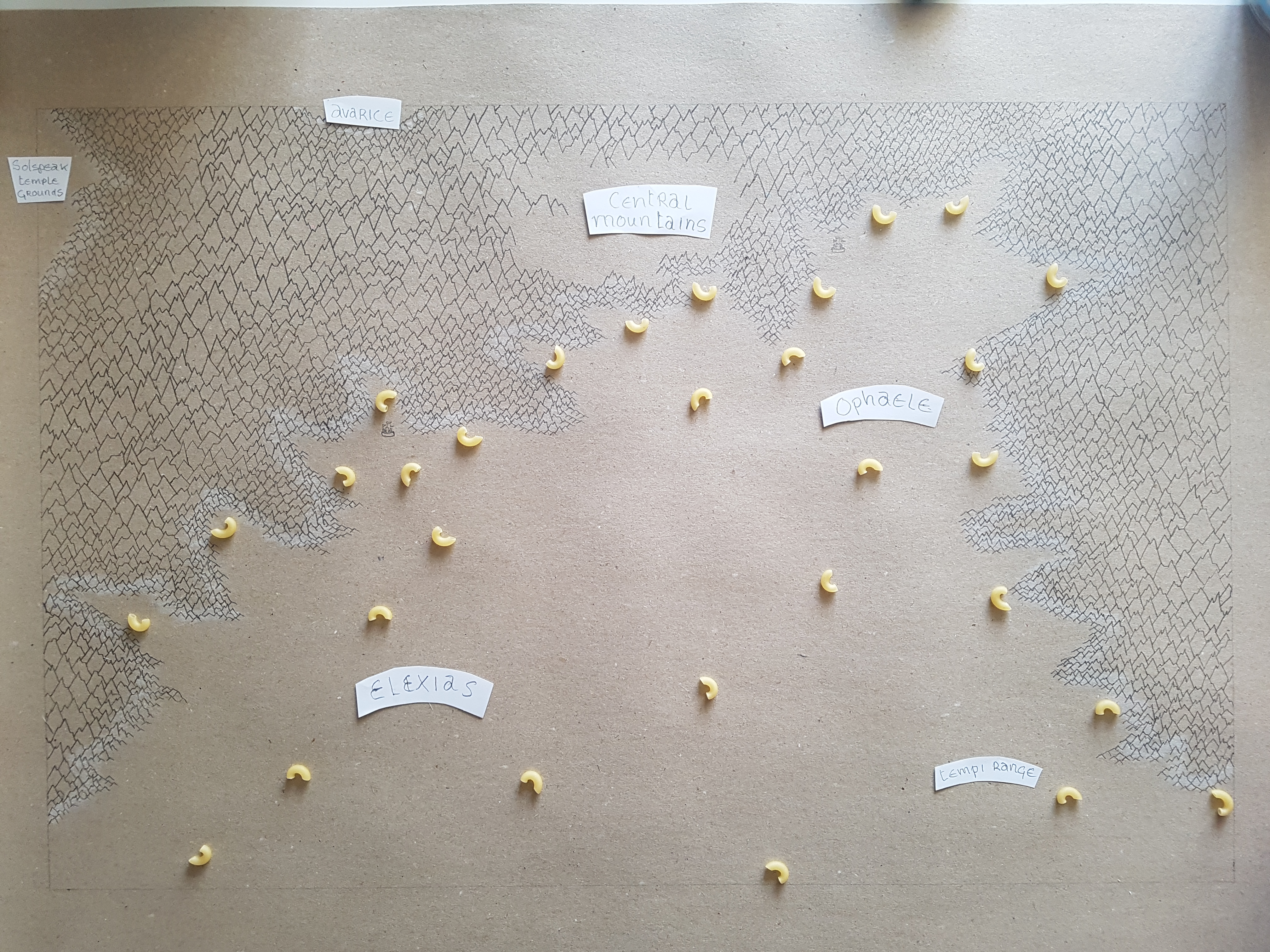
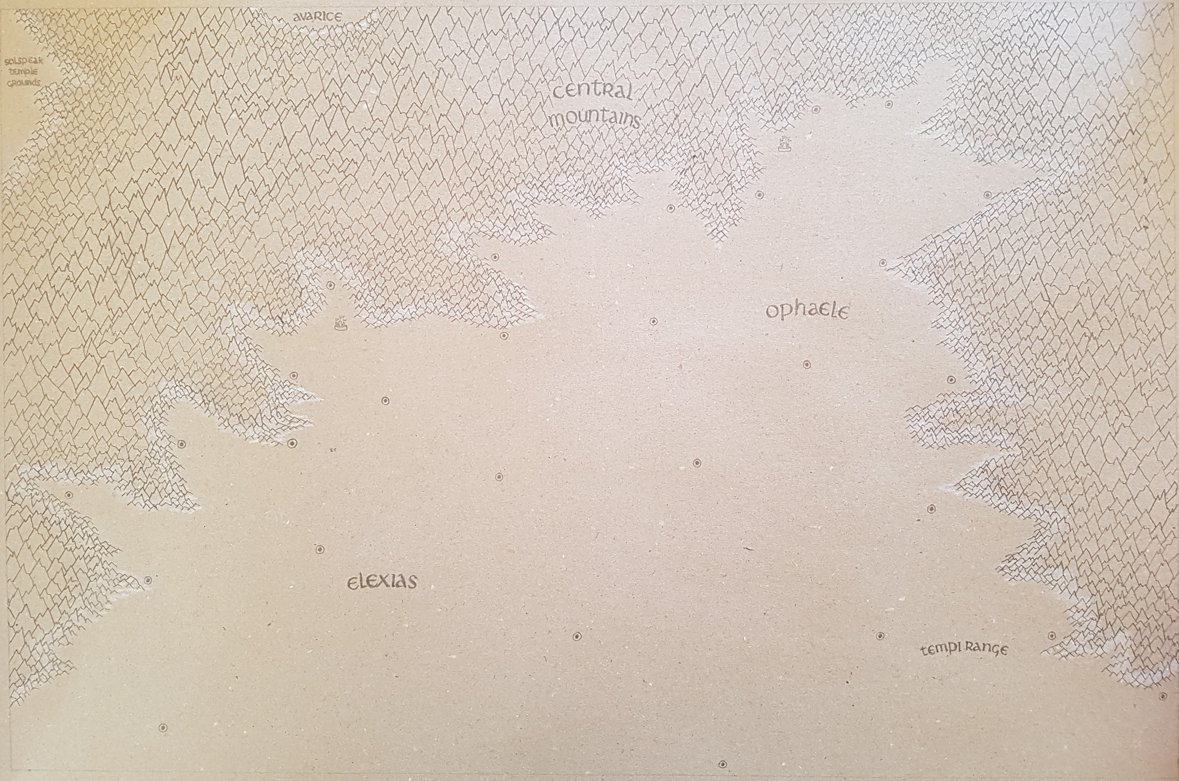
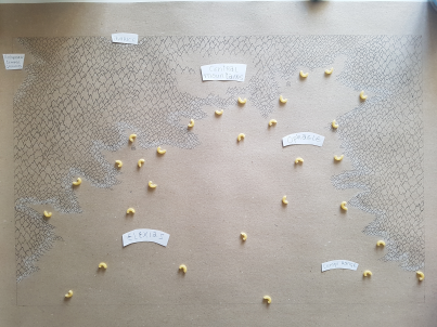
Time to get some names and locations onto our map

minor locations as well

Locations, locations, and trade routes

Adding major forest

and more forest, I wish it was that simple in real life...

Details and fillers, hills, plains, desert etc

Final details and fillers

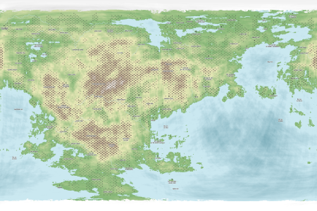
Final version

Some words on the process on such a large canvas (100*70 cm) and the density of detail
At all times, when I work and area on these large canvases, I allways carefully place a peace of paper on the canvas to rest my hands on. The paper prevents any grease or perspiration from your hands reaching the canvas, this is important the surface is porouse and receptable. But even placing a piece of paper and gently removing it again when you are done, will take away some amount of graphite, do that 1000 times and the graphite work underneath will start to look worn. Finishing the mountains with paperpen should probably be deferred to later. And on the same account you should defer coastal brushing and the fine detail work to the very end. In this case I didn't and the mountains took a beating, so i had to sharpen them and brush them with paperpen once again to achieve the contrast i wanted. I have recently developed a dangerous passion for inking up some things in my maps, lets see how that fans outs...